

Hong Kong has been my home for many years, but all the different landscapes that can be found around town still surprises me. Although this isn’t an official trail, I think it’s safe to say that Por Lo Shan’s unique views makes it worthy of a visit.
**Important note**: Part of the route is close to the Tsing Shan Firing range, so be sure to check the firing schedule on the Government website (just type in “firing practice” in the search bar) before you make your way over.
To get to Po Lor Shan, you first need to take the MTR west rail line to Siu Hong, then switch over to the light rail to Leung King Station. From there, the most tricky bit is finding the start of the trail towards Leung Tin Au (良田坳), but if you’re in doubt, ask a local and they’ll gladly point you in the right direction.
The entire distance of the hike is approximately 8km, taking approximately an hour for the ascent, and an hour for the descent. It begins with a steep 30-minute climb on paved road — be sure to bring a hat (or umbrella), as the trail is mostly unshaded.

Steadily making our way up to Leung Tin Au

Discovering wildlife on the way up

View from halfway to the top of the climb
When you get to the top of the steep hill, the route will change from a paved road to dirt and rocks. The path is clearly defined, so don’t worry about getting lost. As this is an unofficial hiking trail, there are no signs along the way.


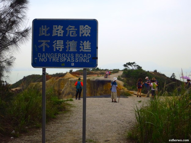
When you reach the warning sign, you have arrived at Por Lo Shan

To reach the other side, you can either take the path to the right (which, as you can see, has a steep drop to one side) or take a lower path (not pictured) further to the right

Once you’ve spent sufficient time taking in the views, it’s time for the descent. At first, you’ll have to navigate through some rocks and loose gravel — it can be a little slippery in some areas, so make sure you wear shoes with a good grip.

The first half of the descent is on rocks, but it connects back to a paved road (Nim Wan Road), where you can catch a minibus back to the MTR.
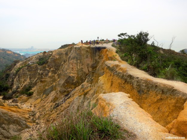
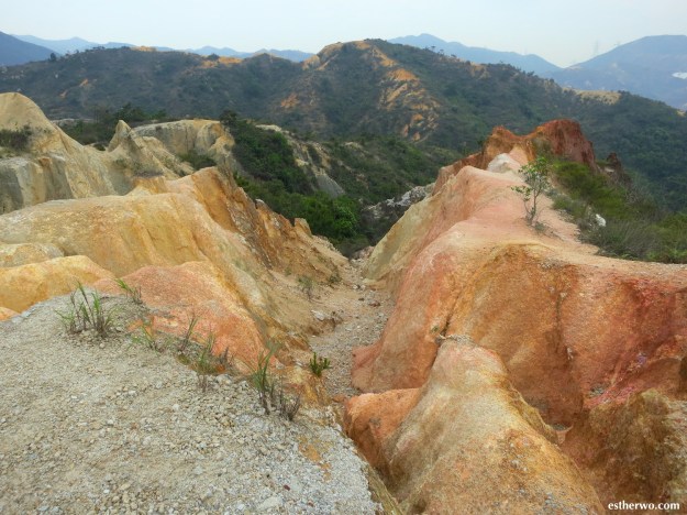
If you ask me, the hike is worth it for the views of Hong Kong’s “miniature Grand Canyon.” It’s a fairly quick hike, but takes a bit of travel time to get there (approximately one hour from Central.)
One downside is that the West New Territories Landfill is located quite close (you’ll see a blue/green tarp in the distance). Depending on the wind directions, the smell can be fairly strong when you reach Por Lo Shan.
How to get there:
From the Siu Hong MTR Station (West Rail line), take the light rail (505/615) to Leung King Station. (Note: if you take the MTR to Siu Hong, there is a free interchange to the light rail) Follow the signs (or ask friendly locals) to begin walking up to Leung Tin Au. From there, Por Lo Shan will be an additional 15 minutes.
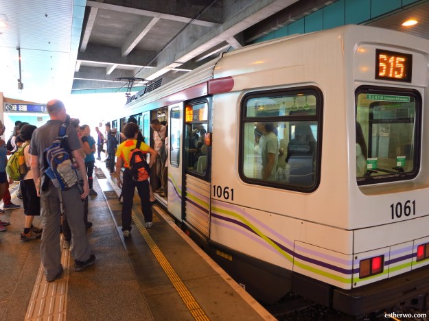
Taking the light rail from Siu Hong to Leung King Station
To get back to the city after the hike, the descent from Por Lo Shan will take you to Ha Pak Nai (下白泥) via Nim Wan Road. When you see a green minibus 33 (HK$11), flag it down and it’ll take you to the Tin Shui Wai MTR Station.
Useful links:
• Government website – type in “firing practice” in the search bar to make sure you don’t go when the site is active
• MTR trip planner
• Light rail route map
• Transportation Department bus route information

So glad I read this, been looking for unusual hikes in Hong Kong and this is the first I’ve heard about this one! Definitely on my list of places to do!